Using Google Maps in the Classroom: Teaching an old software new tricks
by Jenna Stoeber
Christmas break is nearing, and with it comes a chance for faculty to catch their breath after a long and hard fall—before revving back up for another semester. The holiday break is ideal for exploring new methods of teaching, so why not start small by finding innovative ways of using familiar, ubiquitous technology?
Whether you’re going across the world or across the street for the holiday, you’re likely to use Google Maps before the end of the year. This free software is so common that most students (and faculty) already know how to navigate it; with the right lesson plan, it is easy to integrate into a classroom setting, and allows student a concrete, visual way of understanding certain kinds of information.
The examples below demonstrate how using Google Maps will put you on the road to success by adding new texture and depth to a lesson, invigorating the learning process for you and your students.
Contextualizing Location
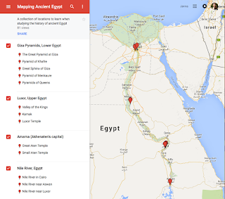
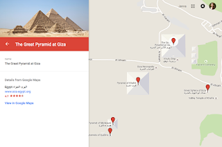
Our first example comes straight from PLU from History Professor Mike Halvorson, who created an interactive map of Ancient Egypt that overlaid modern-day Egypt for his course on Western Civilization. Students can zoom in on important locations and monuments, while still able to keep these locations rooted in a global context.
 |
| Halvorson marks sites down the Nile River. Click to view larger. |
 |
| Bird’s eye view of the pyramids. Click to view larger. |
For students of literature, it can be thrilling to see how the people and places in a work of fiction can crossover into the real world. This is especially true for books where location plays an important role, such as in James Joyce’s classic, Ulysses. Using a map like the one below, students can follow, chapter-by-chapter, as the protagonists journey around real-life Dublin.
Click on the locations in this interactive map to see how context has been applied.
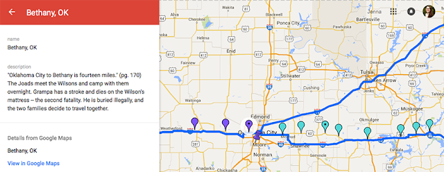
Likewise, what better way to follow the road-trip of the Joad family in John Steinbeck’s The Grapes of Wrath than a Google Map? This map includes both quotes from the book and a short description of notable events that take place along each stop, helping to visualize the dramatic length and difficulty of the journey.
 |
| The Joads’ long journey along Route 66. Click image to view larger. |
Language faculty may find it useful to help students visualize the diversity of locations where a language is spoken, as seen in this map by French teacher Samantha Decker via her blog, The French Corner: a blog about teaching French. This map marks francophone countries across the globe, and can be incorporated into a discussion of how a foreign language became important in these regions.
For more information on creating custom maps, check out Google’s My Maps documentation.
Google Earth
More adventurous faculty might try playing with Google Earth, a free software built using extensive satellite imagery, with the principle focus of exploration. Whereas Google Maps is great for routes and marking distances—perfect for visualizing the Joad’s arduous trek—Google Earth shows faculty and students an overhead view of any location on the planet, and even some in space! You can design tours that include text, pictures, landmarks, close-ups of 3D buildings and geographical features, and more.
Some excellent examples of innovative Google Earth topics include:
 |
| Each stop includes the story of a real diamond miner. Click to view larger. |
- The moral and social issues surrounding worldwide diamond mining and trade.
- Energy consumption across the globe.
- Glacier change over the last 50 years.
- Cause and effect of the Boxing Day Tsunami.
- Google Lit Trips features dozens of downloadable literary tours, including Zora Neale Hurston’s Their Eyes Were Watching God, Cormac McCarthy’s Blood Meridian, and The Travels of Marco Polo.
Google Earth is easily applied to a variety of topics, and there is no shortage of tutorials to help you get started. For a browser-based software, consider using Google’s Tour Builder software, which also has plenty of online help available.
Virtual Tours
The excitement doesn’t end there! A wealth of ready-to-use virtual tours can be found online, providing an in-depth look at sights that would otherwise be very difficult to visit on a field trip.
Here are some of our favorites:
- Get mesmerized with an up-close look at the ceiling of the Sistine Chapel—closer than you could get in person!
- Flip through first-editions of Galileo, Copernicus, and Shakespeare at the digital Rare Book Room.
- Experience 6,000 years of history at The Virtual Museum of Iraq.
PLU Resources
For help creating a Google Maps or Google Earth tour, set up an Instructional Technology consultation with Jenna Stoeber at itech@plu.edu


